 |
It is impossible to walk through Ruyton without being
constantly aware of the red sandstone, in fact the eastern end of the village
is called the Brownhill —not exactly an original name when one sees the number
of sandstone cottages, many now rendered, the sheer cliff of rock into which
the War Memorial is carved and the old quarry where the builder of Red Rocks
did not have a large bill for transportation of building materials.
This sandstone varies considerably in hardness
dependent on the "cement" which holds the grains of sand together. Some
of the cottages have stood for over 200 years and yet we have dug pieces out of
our garden which fall apart as you pick them up. It is noticeable that many
walls which are close to the road have started to erode in recent years due to
chemical action by salt used on the roads in the winter. This "New"
red sandstone was laid down 200 million years ago in the period geologists call
Triassic when this part of Shropshire was an arid desert.
The sandstone then started to be laid down by gigantic rivers caused by
flash floods. These rivers also brought with them stones and pebbles worn
smooth and round by the action of the water. Each flood made a layer of sand
sometimes millimetres and sometimes many feet thick. The weight of succeeding
layers compacted the sand into stone over the next few million years.
After the ice
had melted, Shropshire was a mixture of forests, except for the bare tops of
hills, and the huge area of water made up of rivers, lakes and marshland. About a mile east of Baschurch
on the north side of the B4397 arc earthworks known as the Berth which consist
of two elevated portions of ground which were probably surmounted by a
settlement of huts, standing in what would have been marsh and linked to each
other and to the mainland by causeways.
Nesscliffe is supposed to have been a centre for Druid worship, and a
small stone circle was said to have existed at Grighill. There are earthworks around the village which
can be seen on aerial photographs but without excavation even the experts
cannot be sure if these are British, Roman or Saxon.
The only evidence we have of
any settlement in the immediate area is that a bronze spearhead found in Ruyton
Moss, the wood on the west side of the track called Watery Lane which runs from
Clyffe House to Lower Hopton. Other
signs of early habitation are two canoes, one of which can be seen in Shrewsbury
Museum, which were found near Ellesmere where there were probably lakeside
villages. Another canoe was found in Bagley and also a small bronze shield.
So, that is the early setting
of our village geology – now look at to topography.
If
you were a family wandering through this
area, through forests with wild animals and dangerous bogs, and were
looking for somewhere to settle, this would be an ideal place to make
your home. Here was a nice hill where you could build a stockade round
your
huts, with a river below for fish, and extensive water meadows for your
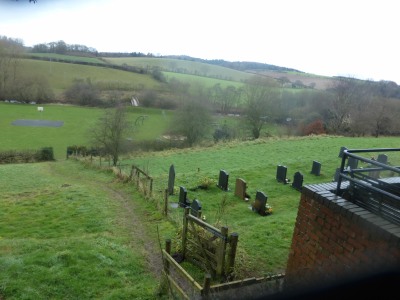
animals. The hills across the river to the north to
protect you, the Brownhill to the east and another hill beyond the river to hinder enemies approaching
from Baschurch, and to the south is the Cliffe. S,o the only way marauding rapers and pillagers could approach, would be from
the West but you would see them coming and they would have to climb up your
hill through your hail of slingstones and spears.
I think the family would agree
with you, this is a great place to settle down.
 |
 |
|
| Pebbles from fields above the valley |
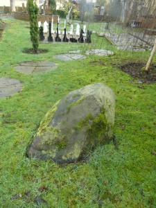
Granite stone dredged from the river in 1986 | Our `standing stone` dredged from the river in 1986 |
 |
||
| Protective hills to the north of the churchyard |